Community Corner
Red Flag Warning Issued for L.A. County Mountains
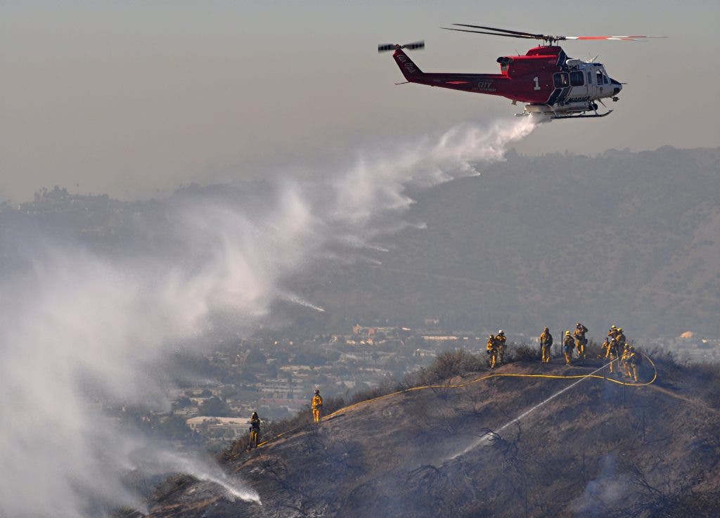
Fire danger is elevated for Los Angeles County mountains during a Red Flag Warning.

A small Santa Ana wind system will blossom Sunday and Monday, causing Red Flag Warnings for all of the mountains of Los Angeles County.
The National Weather Service issued Red Flag Warnings for the mountains of Los Angeles and Ventura counties as of 7 p.m. Sunday, and extended those warnings to the Santa Monica Mountains and Malibu regions effective at 10 p.m. Sunday. In those areas, wind gusts of up to 40 miles per hour were likely to blow into Monday afternoon.
Fire danger will be elevated in the mountains, as temperatures will be about 85 and the humidity levels will drop below 12 percent, the National Weather Service said.
Find out what's happening in Sierra Madrewith free, real-time updates from Patch.
Here is the National Weather Service forecast for Altadena:
- This Afternoon Sunny, with a high near 94. South southwest wind around 5 mph.
- Tonight Clear, with a low around 59. Southwest wind around 5 mph becoming calm in the evening.
- Tuesday Sunny, with a high near 86. East wind around 5 mph becoming southwest in the morning.
- Tuesday Night Clear, with a low around 57. Southwest wind around 5 mph becoming calm in the evening.
- Wednesday Sunny, with a high near 80. Light and variable wind becoming southwest 5 to 10 mph in the morning.
- Wednesday Night Patchy fog after 10pm. Otherwise, mostly cloudy, with a low around 56.
- Thursday Patchy fog before 10am. Otherwise, partly sunny, with a high near 69.
- Thursday Night A slight chance of showers. Mostly cloudy, with a low around 49.
For the rest of the Southland, clear skies and warm air is predicted. Beach-area highs are forecast to be in the lower and mid 70s.
Find out what's happening in Sierra Madrewith free, real-time updates from Patch.
On Monday, beach highs could top 80 degrees in spots.
The balmy weather should continue through Tuesday, when highs are forecast to be in the upper 70s at the beaches and the upper 80s in the valleys and inland areas.
Wednesday should be cooler but sunny, then increasing clouds Thursday night will bring a 20 percent chance of rain -- snow at the highest elevations - - by early Friday, according to the NWS.
An upper-level high pressure system over California, coupled with surface high-pressure over the Great Basin, is responsible for the offshore airflow and warm, dry conditions.
The red flag warnings and fire weather watches were canceled because NWS models indicated conditions just shy of warning levels -- gusts exceeding 35 mph, with relative humidities less than 15 percent, persisting for more than six hours.
Get more local news delivered straight to your inbox. Sign up for free Patch newsletters and alerts.